[ad_1]
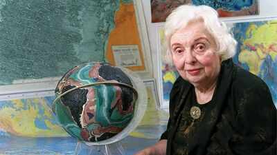
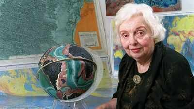
For much of the twentieth century, the deepest parts of the oceans remained among the least understood places on Earth. Ships crossed vast stretches of water every day, yet almost nobody knew what lay beneath them beyond scattered depth measurements collected for navigation. The seabed was often imagined as a broad, featureless plain interrupted only by occasional underwater mountains. That picture gradually changed through years of patient map-making rather than dramatic expeditions.At the centre of that change was Marie Tharp, a geologist and cartographer who transformed thousands of separate measurements into the first convincing images of the ocean floor. In 1957, her pioneering work helped create one of the earliest detailed maps of the Atlantic Ocean floor, revealing features hidden beneath the waves for centuries. Her maps quietly reshaped geological thinking and helped reveal that the Earth’s surface is far more dynamic than many scientists had believed.
How Marie Tharp’s early love for maps shaped her scientific journey
Marie Tharp grew up around surveying equipment, maps and field notebooks. Her father worked as a soil surveyor, travelling to different parts of the United States to record the character of the land. As a child she often accompanied him, watching how landscapes could be measured, classified and drawn with remarkable precision.Those experiences left a lasting impression. Although geology was not a common career choice for women at the time, the Second World War briefly widened opportunities as universities encouraged women into scientific subjects while many men served in the military. As reported, Tharp studied geology at the University of Michigan before later adding mathematics to her education while working in Oklahoma’s petroleum industry.The work paid the bills, but it offered little room for the kind of scientific investigation that interested her most.
The data that revealed the secrets of the deep sea
According to the Library of Congress, a move to New York opened an entirely different path. Tharp joined the Lamont Geological Observatory as a cartographic assistant, where researchers were collecting growing amounts of information about the world’s oceans.The irony of her career was impossible to ignore. Women were generally excluded from research voyages, meaning she could not participate in the expeditions gathering the data she would eventually become famous for interpreting. While male scientists spent weeks at sea, Tharp remained in the office surrounded by charts, calculations and rolls of paper.That limitation shaped her work rather than stopping it. She focused on interpreting sonar measurements returned by research vessels. Each sounding recorded the depth of water beneath a ship by measuring the time taken for sound waves to travel to the seabed and back. Individually those numbers revealed very little. Together they hinted at an unseen landscape.
From isolated readings to the first detailed view of the seafloor
Long before digital mapping became possible, every profile had to be drawn by hand. Tharp plotted depth after depth, producing cross-sections that traced the shape of the Atlantic floor beneath individual ship tracks. Patterns slowly began to emerge.Across several independent profiles she noticed a deep valley running along the middle of the Atlantic Ocean. It appeared repeatedly despite coming from different surveys. The consistency persuaded her that this was not an error but a genuine geological feature stretching across enormous distances.From those separate profiles she gradually built three-dimensional sketches, then larger physiographic maps that showed underwater plains, mountain chains and deep valleys in ways that scientists had never previously seen. Much of the work involved informed judgement, connecting isolated measurements into a coherent picture while remaining faithful to the available evidence.
How a deep ocean valley helped rewrite geology
The valley running through the Mid-Atlantic Ridge carried implications that extended well beyond mapping. At the time, many geologists remained unconvinced by the idea that continents had moved across the Earth’s surface. Continental drift was regarded with considerable scepticism because there appeared to be no convincing mechanism capable of driving such movement.Tharp’s maps suggested something different was happening beneath the oceans. Instead of presenting an unchanging seabed, they pointed towards a long fracture extending through the centre of the Atlantic.Her interpretation was initially dismissed by some colleagues. Bruce Heezen, who worked closely with Tharp, reportedly questioned the finding when she first identified it, reflecting the scientific assumptions of the period rather than the evidence she had assembled.
Earthquakes provided another piece of the puzzle
Fresh evidence arrived from an unexpected direction.Heezen and colleague Howard Foster were examining the locations of underwater earthquake epicentres as part of wider oceanographic research. When those earthquake positions were compared with Tharp’s maps, they formed a striking pattern. The seismic activity closely followed the same central valley she had identified from the depth profiles, as reported by the Library of Congress.The agreement between two completely different sets of observations strengthened the argument that the feature was real and geologically significant. As researchers expanded similar mapping into other oceans, the same relationship between mid-ocean ridges and earthquake activity continued to appear.Those observations became an important contribution to the developing theory of plate tectonics, which explains that the Earth’s outer shell is divided into moving plates whose interactions shape continents, mountains and ocean basins.
Drawing the world beneath the sea
Tharp continued refining ocean-floor maps for more than two decades as new surveys added detail to previously unexplored regions.The work steadily expanded from the North Atlantic to a global scale. Improved datasets allowed increasingly complete representations of underwater terrain, revealing mountain ranges longer than any found on land, broad abyssal plains and trenches descending to extraordinary depths.In the late 1970s, Austrian landscape artist Heinrich Berann transformed Tharp and Heezen’s scientific interpretations into a richly detailed painted world map of the ocean floor. It became the first widely recognised visual representation of global seafloor bathymetry, allowing both scientists and the public to see the interconnected structure of the underwater world in a single image.Although artistic in style, the painting rested on decades of geological interpretation and careful cartographic work.
The maps that finally earned their place in scientific history
Like many scientific contributions made behind the scenes, Tharp’s achievements were not immediately recognised outside specialist circles. Her role was sometimes overshadowed despite the central importance of the maps she produced.As geological understanding evolved and plate tectonics became accepted, appreciation for her work grew. Scientists increasingly recognised that accurate visualisation had played a significant part in changing how the Earth’s structure was understood. The ability to see relationships hidden within scattered measurements proved just as valuable as collecting the measurements themselves.Reportedly, in 1995, Tharp donated the research materials she and Bruce Heezen had assembled over decades. The archive included maps, notebooks, correspondence, geological records and original cartographic material, preserving the history of work that fundamentally altered humanity’s picture of the ocean floor.
A different way of seeing the planet
Marie Tharp never needed to descend into the deep ocean to change how people understood it. Working from offices filled with charts instead of aboard research ships, she reconstructed landscapes that nobody had previously seen with such clarity. Her maps demonstrated that the seabed possessed structure, movement and history rather than being an empty expanse beneath the waves.Modern satellite observations, digital bathymetric models and advanced underwater exploration have added immense detail since then, yet many of those developments rest on foundations laid by her careful interpretation of thousands of handwritten measurements. The hidden geography beneath the oceans first became visible because someone was willing to look patiently at the evidence until the landscape emerged.
[ad_2]
Source link